


September 30, 2015
Since the first part of our Guide to the Seven Summits, you’ve had plenty of time and we have no doubt, that you’ve already been to the summit of every single one of the giants we have a introduced to you. Here’s the list for your next hiking and climbing adventures to the remaining four of the Seven Summits. Challenge accepted? Ready. Steady. Go!
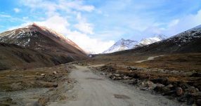
Australia – Test Your Limits Climbing Carstensz Pyramid.
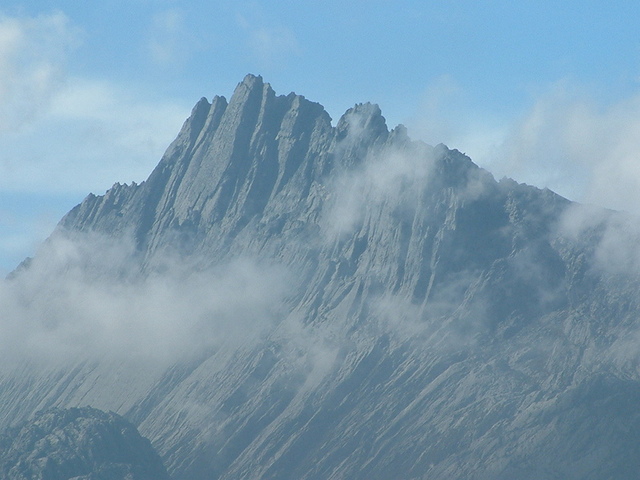
Puncak Jaya. Photo by Alfindra Primaldhi.
Carstensz Pyramid, or Puncak Jaya is with 4884m the highest summit of Mount Carstensz in the Sudirman Range in the Papua Province, Indonesia. Papua, you might wonder? Yes, this part of Indonesia is on the Australian tectonic plate and thus belongs to the continent of Australia.
The mountain got its name after the Dutch explorer Jan Carstens, who was the first westerner to see its snowy peak in the distance in 1623. Unfortunately, back in Europe he was ridiculed for his report, since nobody wanted to believe in snow so close to the equator.
In 1936 the Dutch Carstensz Expedition made its way up the mountain. It was not confirmed yet, which of the three summits was the highest one, but the expedition found a simple solution for this problem: they just tried to climb each of them. And they actually reached the summits of the East Carstensz and Ngga Pulu, but failed at Carstensz Pyramid.
To the defense of Anton Colijn, Jean Jacques Dozy and Frits Wissel must be said, that it is highly probable, that at this time actually Ngga Pulu might still have been the highest one. Only after the glaciers on the summit had significantly melted, Carstensz Pyramid got the honorary title.
In 1962 finally an expedition lead by the legendary Austrian mountaineer Heinrich Harrer conquered the summit of the Carstensz Pyramid.
With the highest technical rating of all Seven Summits, Carstensz Pyramid is definitely no easy hike. Rock climbing experience is absolutely essential, and even if you think you are already quite good at it, some intensive training might still do some good. But the difficulties don’t only start when you reach the steep, rocky walls of the Pyramid, it is already quite a challenge to even get to the mountain, which is set in the middle of the Indonesian jungle. You can fly to Timika and from there take a small plane to one of the shady, unpaved runways of one of the surrounding villages. From there it is still a 5 day long hike through jungle, rain and slippery terrain to get to the base camp. Every injury that might happen during this trek – and the most accidents happen on that part on the way back – must be evacuated by foot the same way you came, since a rescue mission with a helicopter is impossible.
The weather at Mount Carstensz is relatively mild, compared to many of the other Seven Summits, with the temperatures on the peak around freezing point.
You need to obtain several permits to travel the area in general and to climb the mountain. Because of the unstable political situation, they are hard to get, and even when you hold them in your hands, you should not necessarily rely on their validity. A journey to the summit of Mount Carstensz is with 12000-18000 USD also relatively expensive.
There are several tour operators who organize trips all year round. This might be a good choice, since they also organize your arrival with the option of helicopter transport to the base camp, which rules out many uncontrollable factors you might encounter approaching the mountain by land.
The standard route leads you up the north face from the base camp at 3760 m. There you should give yourself some days to acclimatize, before your final one day push to the summit, climbing the steep walls of Carstensz Pyramid.
Europe – Take it Easy on Mount Elbrus.
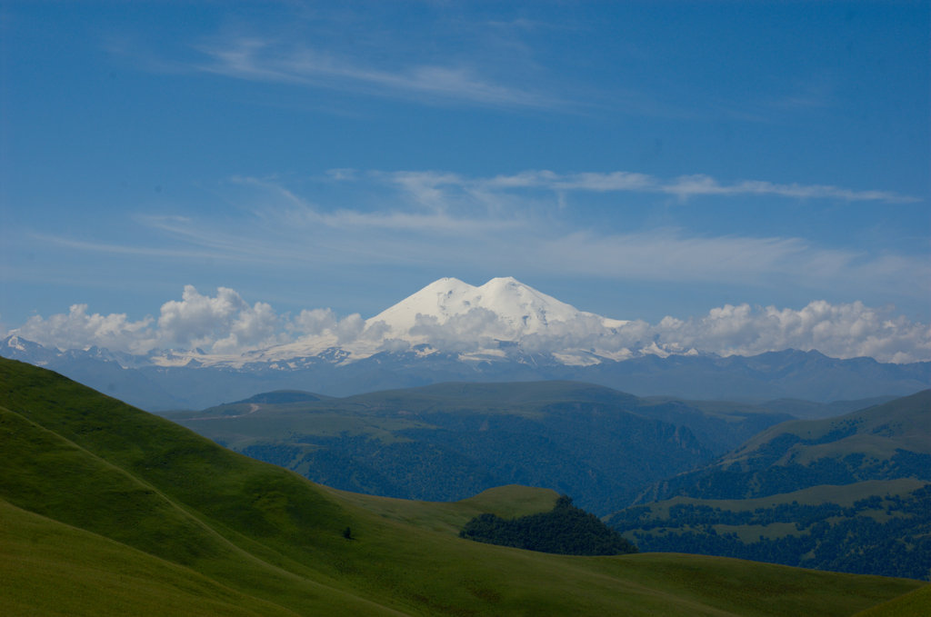
View on Mount Elbrus. Photo by Konstantin Malanchev.
This 5643 m high mountain in Russia near the Georgian border, is a legendary place in the Western Caucasus Mountains, where Zeus is supposed to have chained Prometheus to the rocks as punishment for stealing the fire from the gods and giving it to the humans. In the light of this story, it is not surprising that the two summits of Mount Elbrus are dormant volcanoes, whose last eruption took place about 2000 years ago. The huge crater is now filled with ice and snow.
The first successful ascent to the lower east summit was done in 1829 by Khillar Khachirov, the Karachay guide of an expedition by the Imperial Russian Army. The just 20m higher west summit was conquered only 45 years later, in 1874, by and expedition under Florence Crauford Grove, an English mountaineer and author.
Mount Elbrus looks back on a turbulent history during the 20th century. For a long time, it was a famous destination for excursions, till 33 young mountaineers tragically died in 1936. During the Second World War, the mountain was occupied by the German military.
During the Soviet Era, mountaineers were strongly encouraged to climb Mount Elbrus. Over the year, starting in 1956, even a cable car system was build, which can take visitors close to the top in different stages.
Technically the mountain is not difficult. But the combination of the cold temperatures, the cold winds and the because of the cable car system relatively easy ascent and the consequent underestimation of the time, which is needed for the acclimatization to the high altitude, Mount Elbrus is with 15-30 fatalities each year one of the world’s deadliest mountains.
The normal route, most people take, starts from the last station of the cable car in an altitude of 3800 m. Making a big part of the ascent quite effortless and leaving a relatively short remaining distance to the peak, there are days in summer when up to 100 people attempt the summit each day, with a success rate of 80-90%. So if you are looking for a solitary mountaineering experience, this is definitely not the right destination for you.
From Mir Station, the end of the cable car system, you can either take a chairlift or walk (about 60min) to Garabashi. From there you can hike on for 1,5 hours to Diesel Hut or take a snowcat. From Diesel Hut it is just a mere 4,5-5,5 hours ascent to the summit. While this all sounds like a short afternoon hike, remember the extreme altitude. You need about a day for each station, to give your body enough time to acclimatize, and it is even better, when you put in a rest day or two (not that you’ve already done something to deserve one).
The other option is Kiukurtliu Route, which starts a little below Mir Station. This one is technically more difficult and you’ll need proper equipment like axes and ropes. Also you’ll have to spend your nights camping in the snow, since the infrastructure of this route is not as well developed as on the normal one.
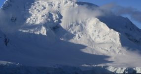
North America – Make it through Ice and Snow at Mount Denali.
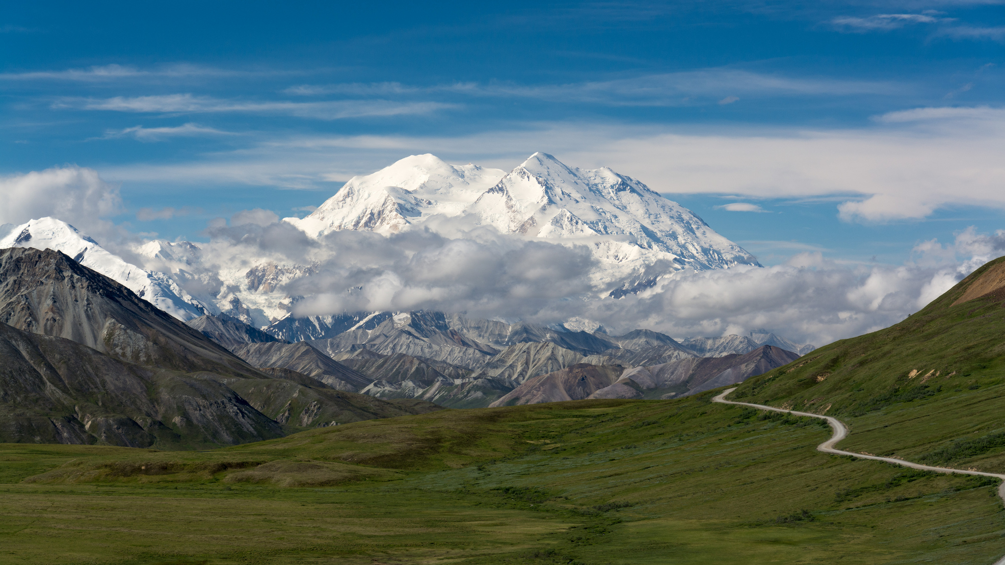
Mount Denali – the Alaskan Giant. Photo by Christoph Strässler.
Mount Denali was only renamed from Mount McKinley a short time ago, and a decade old fight about the appropriate name of North America’s highest mountain in South-Central Alaska finally ended. Denali, in the Alaska Range, is with 6190m on its south summit a true giant, the northern summit being a little bit smaller. Measured not by the summit’s elevation above sea level, but by its rise from the base to the summit, it is even higher than Mount Everest.
Probably the first westerner, who laid eyes on Mount Denali, was George Vancouver, who refered to some “distant stupendous mountains” in his journal in 1794. In 1906 explorer Frederick Cook claimed to have been the first one who had reached Denali’s summit, but he never could proof it. Walter Harper, Hudson Stuck and Harry Karstens were the first ones, who verifiably ascended Mount Denali’s higher south summit in 1913.
There are several routes up the mountain, some quite technical, some easier. The most used one is the West Buttress Route, with a success rate of 50%. Hikers typically take two to four weeks for the whole enterprise. While it is technically not too demanding, the extremely cold climate (Mount Denali is further north than any other of the Seven Summits), the strong winds and the high altitude many accidents happen. Denali has claimed a death toll of more than 100 climbers already.
May to July is the best hiking season, with the highest success rate in June. During the winter months the jet stream can reach up to 160 km/h. This and temperatures around -50 to -30°C make it basically impossible to ascend the mountain during winter.
South America – Fight the Storms on Mount Aconcagua.
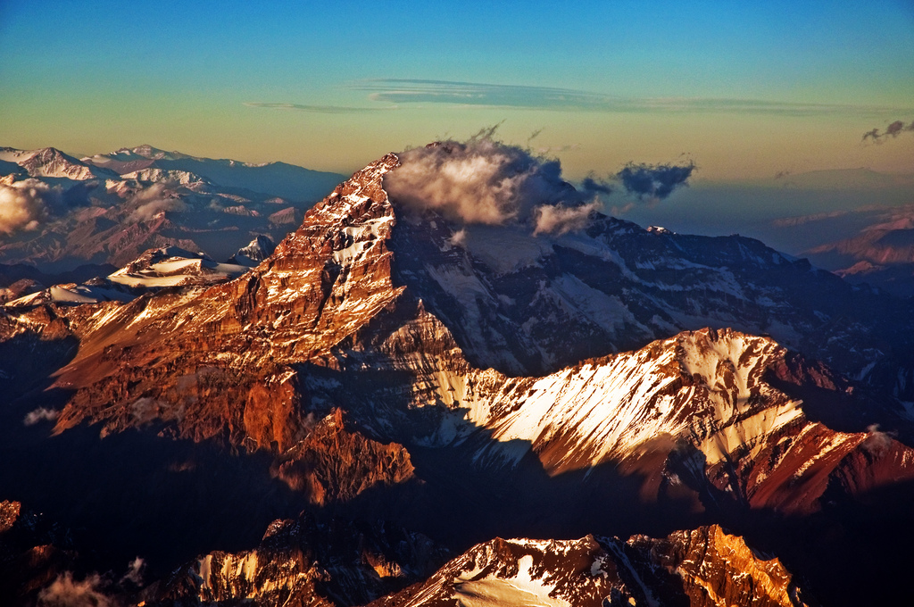
Flying over Mount Aconcagua. Photo by Phillip Capper.
Aconcagua, with 6962m the highest mountain of South America and in the western hemisphere, lies in the the Andes in Western Argentina. The best climbing season is December to March and no matter when you go, you always need a permit. Prices range between around 100 USD and 1000 USD, depending on the season, the route and the length of the trekking trip.
Before the times of permits and guided tours, the first expedition, who tried to ascent Aconcagua in 1883, lead by German geologist and explorer Paul Güssfeldt, did not succeed. Only in 1897 an expedition under the command of British mountaineer Edward FitzGerald reached the summit. Tragically FitzGerald himself, who already had failed 8 times before, did not make it to the top himself, but the Swiss guide of the expedition, Matthias Zurbriggen.
Aconcagua is probably the highest non-technical mountain in the world, with the normal northern route being a walk-up not requiring any technical equipment like ropes and axes. But still an ascent to the top of Mount Aconcagua is far from being an easy hike. The low oxygen, the extremely cold temperatures and the stormy winds are the factors you’ll have to fight.
Many underestimate the South American giant and come completely unprepared, hence the success rate is only around 40%. Lucky are those, who realize early enough, that they have to return and get back safely to the base camp. Not so lucky are those, who have contributed to Aconcagua’s nickname, the Mountain of Death.
From the base camp of the North Route, which is the easiest one, you usually tackle 3 more camps. From the last one you can reach the summit and return in about 8-12 hours.
Another option is the Polish Traverse Route on the east side with the base camp at Plaza Argentina at around 4000 m, which takes 3 days to reach. There are two more camps and from the second one you can start your attempt to the summit and return in 7-12 hours.
The infrastructure of Mount Aconcagua is relatively good and there are several camps you can choose from. The whole trip to the summit usually takes about two weeks, with some rest days to acclimatize to the altitude.
There are no permanent snow fields on the Normal and the Polish Traverse Route. A big part of the mountain is covered with scree, which is not easy to hike. When these areas are covered with snow and ice after the winter, the ascent is easier.
The third option is to take the mountain from the south side, where you’ll find some of the most difficult routes in the world.
Liked this article? Looking for the latest in travel and adventure news? Then check out the rest of our articles at Adventure Herald. You can also like us on Facebook, follow us on Twitter or Instagram to keep up with our latest antics.
Tag 7 summits adventure adventure travel Alaska argentina australia climbing euroe extreme hiking extreme sports hiking indonesia north america russia seven summits south america trekking

In adventure travel news, n innovative new natural desert reserve spanning 10 percent of the total area of Dubai has been launched in the UAE. The Marmoon Desert Reserve Project is set to be the site of several ecotourism projects and conservation efforts contributing to the protection and nurturing of the environment,…


Hot Topics
In adventure travel news, n innovative new natural desert reserve spanning 10 percent of the total area of Dubai has been launched in the UAE. The Marmoon Desert Reserve Project is…

